motivated me into pursuing
an education in teaching.
Mom & Dad, I love you!
This book was created and published on StoryJumper™
©2010 StoryJumper, Inc. All rights reserved.
Publish your own children's book:
www.storyjumper.com
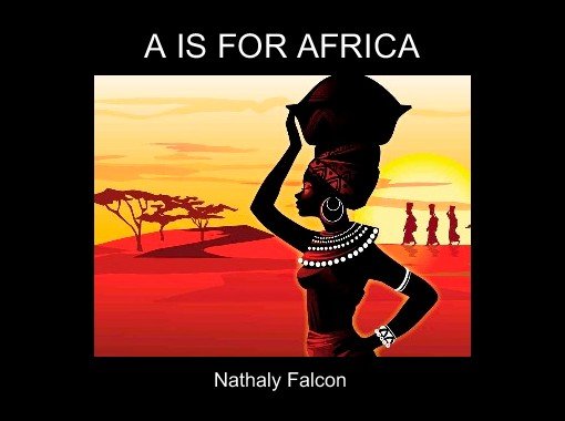
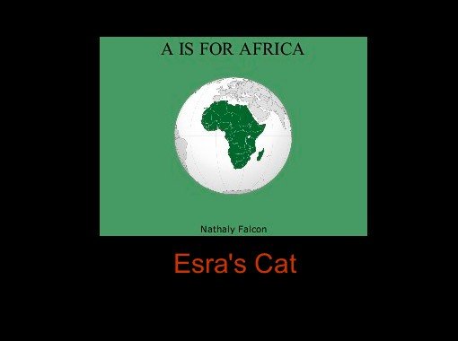
A IS FOR AFRICA
Nathaly Falcon
Table of Contents
Title page ...........................P.1
Africa.................................P.3,4
Bani river............................P.5,6
Congo river........................P.7,8
Desert................................P.9,10
Ethiopian highlands.............P.11,12
Fachi oasis.........................P.13,14
Great rift valley...................P.15,16
Horn of africa.....................P.17,18
Ituri rainforest.....................P.19,20
Jebel marra.........................P.21,22
Kalahari desert...................P.23,24
Lake victora.......................P.25,26
Mount kilimanjaro..............P.27,28
Nile river............................P.29,30
Orange river..................P.31,32
Plateau..........................P.33,34
Quicksand.....................P.35,36
Rivers............................P.37,38
Sahara...........................P.39,40
Tanganyaki lake.............P.41,42
Ukerewe island..............P.43,44
Victoria falls...................P.45,46
Wof-washa forest...........P.47,48
Xeric shrublands.............P.49,50
Yawri bay......................P.51,52
Zambezi river.................P.53,54
Index.............................P.56
Glossary........................P.57,58
A is for Africa
Africa is the second largest of the worlds seven continents.
Africa contains fifty-three countries and is surrounded by
the Red Sea, Indian Ocean, Mediterranean Sea, and the
Atlantic Ocean.Africa is the second largest of the worlds
seven continents. Africa contains fifty-three countries and is
surrounded by the Red Sea, Indian Ocean, Mediterranean Sea,
and the Atlantic Ocean.
B is for Bani River
The Bani River is the principal tributary of
the Niger River in Mali.The river is formed
from the confluence of the Baoulé and Bagoé
rivers some 60 km east of Bamako and it merges
with the Niger near Mopti.
C is for Congo River
The Congo River is a river in Africa and the world's deepest river with
measured depths in excess of 720 ft. Because the river flows for the most
part near the Equator, the area around it is very hot. Much of the land
surrounding the river is tropical rain forest and is home to hundreds of
kinds of animals, including hippos, manatees, water snakes, crocodiles,
tortoises, pigs, elephants, and 200 species of fish.
D is for Desert
Africa has some of the most dramatic deserts in the world. A desert is
a barren area of land where little precipitation occurs and consequently
living conditions are hostile for plant and animal life.
Africa boasts seven different deserts:
Blue Desert – a desert in Egypt
Kalahari Desert – a desert covering much of Botswana
Libyan Desert – part of the Sahara located in Libya
Namib Desert – a desert in present day Namibia
Nubian Desert – a desert in present day Sudan
Owami Desert – a desert in Nigeria
Sahara – the world's largest desert
E is for Ethiopian Highlands
The Ethiopian Highlands are a rugged mass of mountains in
Ethiopia. It forms the largest continuous area of its altitude in the
continent, with little of its surface falling below 4,921 ft, while the
summits reach heights of up to 14,928 ft. It is sometimes called the
Roof of Africa due to its height and large area.
Ff is for Fachi Oasis
Fachi is an oasis. An oasis is a small fertile or green area in a
desert region, usually having a spring or well. It has an estimated
population of some 2000 people.
G is for Great Rift Valley
The Great Rift Valley is a deep rift or split in the earth that stretches
from Syria to Mozambique. Africa's major lakes have formed along the
Great Rift Valley. The area is geologically active, and features hot
springs, geysers, and frequent earthquakes.
H is for Horn of Africa
The Horn of Africa is a peninsula in Northeast Africa that juts
hundreds of kilometers into the Arabian Sea and lies along the
southern side of the Gulf of Aden.
It covers approximately 770,000 sq mi and is inhabited by roughly
100 million people.
I is for Ituri Rainforest
The Ituri Forest is a dense tropical rain forest in the northern
part of the Congo River Basin. It covers a vast area of land in
central Africa. The dense trees, vines, and fallen logs in the vast
Ituri Forest provide habitat for the shy, endangered okapi, forest
elephant, owl-faced monkey, antelopes, weavers, and a great
variety of butterflies and insects.
J is for Jabal Marra
Jabal Marra volcano is located in Darfur province, western Sudan, 200
km from the border with Chad, and about 100 km north of the town
of Nyala. It is the second highest peak in Sudan. The Marra plateau
covers 12,000 sq km from Tabago Hills to Tebella Plateau. The upper
reaches of the massif is a small area of temperate climate with high
rainfall and permanent springs of water.
K is for Kalahari Desert
The Kalahari Desert is a large dry sandy savanna in southern
Africa extending 350,000 sq mi, covering much of Botswana
and parts of Namibia and South Africa. A semi-desert, with huge
tracts of excellent grazing after good rains, the Kalahari supports
more animals and plants than a true desert.
L is for Lake Victoria
Lake Victoria is the largest lake in Africa and the source of the
worlds longest river, the Nile. It is located in Tanzania and
Uganda with a small part extending into Kenya. This body of
water is named after Queen Victoria of the United Kingdom.
Lake Victoria is about 400,000 years old.
M is for Mount Kilimanjaro
Mount Kilimanjaro is the highest point in Africa. Located in
Tanzania, the volcanic Mount Kilimanjaro soars 19'321 feet. It
is also permanently snow capped. There are three volcanoes on
Kilimanjaro - Mawenzi, Shira and Kibo. Mawenzi and Shira are
extinct, but Kibo is dormant. The last major eruption was 360,000
years ago.
N is for the Nile River
The Nile is a major north-flowing river in northeastern Africa,
generally regarded as the longest river in the world. Located in
Africa, the Nile River lies in the following countries: Kenya,
Eritrea, Congo, Burundi, Uganda, Tanzania, Rwanda, Egypt,
Sudan and Ethiopia.
O is for Orange River
The Orange River is the longest river in South Africa. The Orange
River plays an important role in the South African economy by
providing water for irrigation, as well as hydroelectric power.
P is for Plateau
A plateau is a large flat area of land that is higher than other
areas of land that surround it. Africa has high plateaus in the east
and south. The whole of the country of South Africa is a plateau,
with high ground on all but its northern border.
Q is for Quicksand
Quicksand is a type of sand that traps living or non-living things in it. It
is so sticky that you cannot escape from it and because of your weight
you start to sink in it. Africa is rich with quicksand.
You've previewed 38 of 59 pages.
To read more:
Click Sign Up (Free)- Full access to our public library
- Save favorite books
- Interact with authors
- < BEGINNING
- END >
-
DOWNLOAD
-
LIKE(9)
-
COMMENT()
-
SHARE
-
SAVE
-
BUY THIS BOOK
(from $11.79+) -
BUY THIS BOOK
(from $11.79+) - DOWNLOAD
- LIKE (9)
- COMMENT ()
- SHARE
- SAVE
- Report
-
BUY
-
LIKE(9)
-
COMMENT()
-
SHARE
- Excessive Violence
- Harassment
- Offensive Pictures
- Spelling & Grammar Errors
- Unfinished
- Other Problem


COMMENTS
Click 'X' to report any negative comments. Thanks!